
Table of Contents
Venice is not simply a city crossed by canals. It is a water world, a historic urban organism built inside the Venetian Lagoon, where streets, squares, bridges, palaces, churches, boats, tides, and channels form one inseparable system. To understand the city, one must first understand Venice canals.
The expression “empire of waters” may sound poetic, but in Venice it describes a real geographical condition. The city grew where land was fragmented, unstable, and surrounded by shallow lagoon waters. Instead of fighting this environment completely, Venetians adapted to it and transformed water into protection, transport, identity, and power.
Unlike most European cities, Venice did not develop around roads leading outward into the countryside. Its historical center developed between islands, mudflats, and salt marshes. This unusual setting made Venice canals the equivalent of streets, service routes, commercial arteries, ceremonial spaces, and everyday passages.
The result is one of the most recognizable urban landscapes in the world. Venice is compact, dense, fragile, and monumental at the same time. Its architecture rises directly beside the water, while boats replace cars in much of daily movement. This is why Venice remains the supreme European example of a city built on water.
The Venetian Lagoon – Geography of a Water World
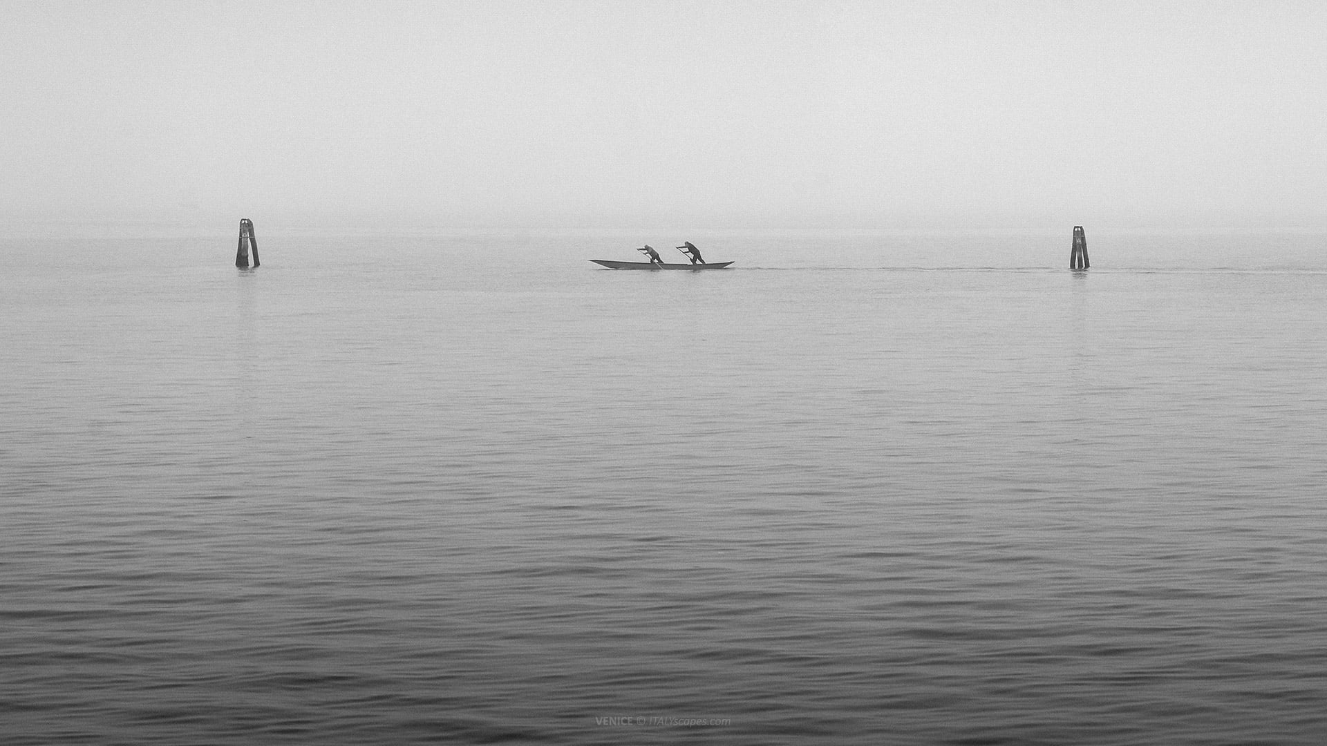
The Venetian Lagoon is the natural setting that made Venice possible. It lies in northeastern Italy, along the Adriatic Sea, and forms a shallow coastal environment between the mainland and the open sea. Its geography includes mudflats, tidal shallows, salt marshes, islands, navigable channels, and lagoon inlets.
This lagoon stretches broadly between the area of the Sile River in the north and the Brenta in the south. It is not a simple body of open water, but a complex wetland system. Parts are permanently covered by water, while large areas change character according to tides, sediment, and human intervention.
The lagoon is connected to the Adriatic Sea through inlets, historically including Lido, Malamocco, and Chioggia. These openings allow the movement of salt water, tides, boats, and sediments.
The geography of the lagoon gave Venice an extraordinary defensive advantage. In the early centuries, the shallow waters and uncertain channels made access difficult for enemies unfamiliar with the area. The lagoon was not a wall in stone, but a natural barrier.
At the same time, the lagoon connected Venice with wider maritime routes. From this watery environment, Venetians could reach the Adriatic and the Mediterranean. This helped the city become a naval, commercial, and political power. The water world was therefore not an obstacle, but the foundation of Venetian success.
Venice developed on islands inside this lagoon, where dry ground was limited and fragmented. Building here required adaptation, engineering, and constant maintenance. The city’s relationship with water was never passive. Venetians shaped channels, reinforced banks, built quays, managed navigation, and defended the balance between lagoon and settlement.
The lagoon also explains the visual uniqueness of Venice. The horizon is low, the water reflects façades, and the city appears to emerge directly from the surface. Unlike hill towns, fortified cities, or mainland capitals, Venice belongs to a landscape where architecture and water constantly mirror one another.
This geography also created vulnerability. High tides, storm surges, subsidence, erosion, and rising sea levels have long threatened Venice. The famous acqua alta is not a picturesque phenomenon, but a reminder that the city’s beauty depends on a difficult and permanent negotiation with the lagoon environment.
Venice Canals as Vital Arteries
The Venice canals are not decorative features added to an ordinary city. They are part of the original structure of the settlement. The islands of Venice were separated by water from the beginning, and the canals became the practical spaces through which people, goods, building materials, and information moved.
In this sense, Venice canals functioned as vital arteries. They allowed boats to reach homes, warehouses, markets, churches, workshops, and palaces. Before modern tourism, the canal system supported trade, daily supply, construction, fishing, transport, and administration. Water was the infrastructure that kept the city alive.
The internal canals also shaped the urban layout. Streets in Venice are often narrow and irregular, while canals create broader lines of movement through the city. Bridges connect land fragments, but boats move through the liquid network below.
Many Venetian buildings have two faces: one toward the pedestrian street and one toward the canal. In important palaces, the water façade was often the most prestigious side. The canal entrance allowed noble families, merchants, ambassadors, and visitors to arrive by boat, giving the water a ceremonial role.
For commerce, the canals were indispensable. Venice imported grain, spices, timber, salt, textiles, and luxury goods through maritime networks. Once goods entered the city, they moved through canals toward warehouses, markets, and private residences. In a city without normal cart traffic, boats carried the material life of the republic.
The canals also supported services that elsewhere depended on roads. Deliveries, waste movement, construction transport, emergency access, and funerary transport could all involve boats. Even today, Venice uses specialized boats for tasks that mainland cities handle with vans, trucks, ambulances, and utility vehicles.
Because canals are active infrastructure, they require rules and maintenance. Navigation, mooring, water traffic, wave motion, dredging, bank protection, and bridge clearance are practical issues. Venice may look timeless from a bridge, but its canal system is a working network with pressures caused by residents, visitors, services, and transport.
The transformation of canals into arteries also changed Venetian culture. Boats became ordinary tools of life, not only romantic symbols. Gondolas, sandoli, bragozzi, cargo boats, and modern motor vessels all belong to different phases of Venetian mobility. The empire of waters developed its own technology, gestures, professions, and vocabulary.

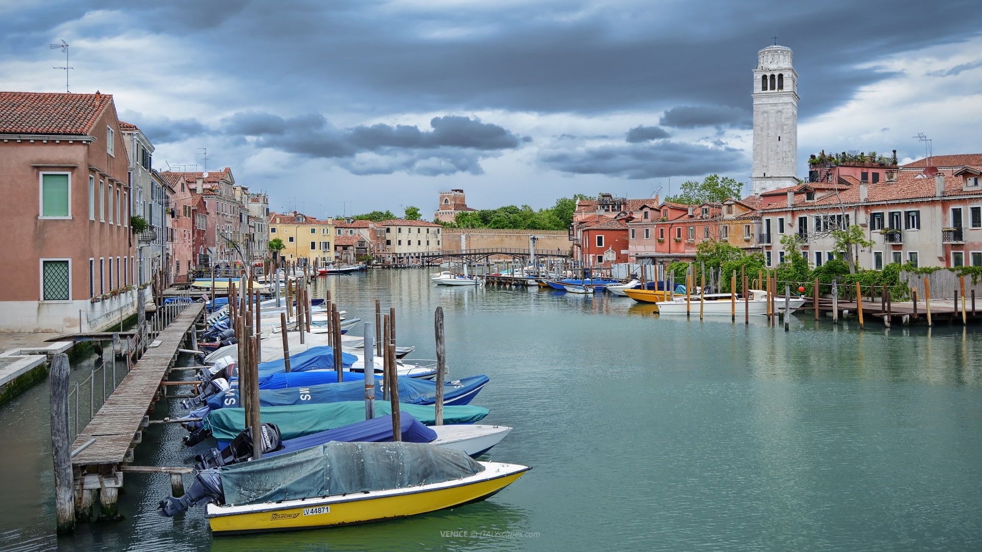
Canale di San Donato, on the island of Murano
The Grand Canal – The Main Water Avenue of Venice
The Grand Canal is the most important waterway in Venice and the central axis of the historic city. It cuts through the urban fabric in a great reverse-S curve, linking the area near the railway station with the basin of San Marco. It is the most famous of all Venice canals.
Known in Italian as Canal Grande, it is about 3.8 kilometers long. Its width varies, generally much wider than the smaller internal canals, and its average depth is greater than that of many secondary waterways. This made it suitable for heavier traffic and more important ceremonial movement.
The Grand Canal is often described as Venice’s main street, but this comparison is only partly accurate. It is more than a street. It is a transport corridor, a historical showcase, a ceremonial route, a commercial line, and an architectural museum where the façades of centuries face the water.
Along its banks stand many of Venice’s most important palaces. These buildings reflect the wealth of merchant families, noble dynasties, foreign trade, and public institutions. Gothic, Renaissance, Baroque, and later architectural forms appear along the canal, making it a chronological display of Venetian urban history.
The Grand Canal had strong commercial importance because it connected strategic points of arrival, storage, and power. Boats could move goods and people through the heart of the city. The proximity of palaces to the water was not accidental; it reflected a society in which status and trade depended on navigation.
Several famous bridges cross the Grand Canal, including the Rialto Bridge, historically the most important crossing. For centuries, the area around Rialto was the commercial heart of Venice. The bridge and its market zone show how the waterway was connected to trade, finance, food supply, and urban exchange.
The Grand Canal also frames some of the most iconic views in Venice. From a vaporetto, water taxi, gondola, or bridge, the city appears as a continuous sequence of façades, landings, windows, balconies, and reflections. This visual experience makes the canal central to the image of Venice worldwide.
Yet the Grand Canal is not only for visitors. It remains an active route for public transport, private boats, deliveries, and local movement. Its beauty can hide its functionality. In Venice, even the most photographed waterway is still part of the living machinery of the city.

Canal Grande – View from the Ponte degli Scalzi
Smaller Canals – Cannaregio and the Hidden Water Network
Beyond the Grand Canal, Venice is crossed by a dense system of smaller canals. These secondary waterways are essential for understanding the city’s real structure. They divide neighborhoods, serve residential areas, connect minor routes, and create the intimate atmosphere that many visitors associate with everyday Venice.
The Canale di Cannaregio is one of the most important examples. Located in the Cannaregio district, it forms a significant water route in the northern part of the city. Before the railway bridge connected Venice more directly with the mainland, this canal was an important entrance route into the city.
Cannaregio’s canal landscape differs from the ceremonial grandeur of the Grand Canal. It is broad and functional, but its atmosphere is more local. Nearby bridges, palaces, churches, and residential buildings show another side of Venice, where the water system supports district life rather than only monumental representation.
Other canals serve smaller-scale movement through the sestieri, the six historical districts of Venice. These waterways may be narrow, shaded, quiet, or lined with modest houses. Some are crossed by small stone bridges; others bend sharply between buildings, creating views that change after every turn.
The smaller canals also create the city’s famous labyrinth. Pedestrian routes often follow indirect paths because water interrupts the land. A destination that seems close on a map may require crossing bridges or walking around a canal. This gives Venice its unusual sense of space and movement.
These waterways are also vulnerable to waves, pollution, erosion, and heavy traffic. Motorized movement can damage canal banks and disturb the fragile relationship between water and masonry. Preserving Venice means protecting not only its famous monuments, but also the smaller canals that sustain the urban fabric.

Canale di Cannaregio
Voga alla Veneta – The Traditional Rowing Style of the Lagoon
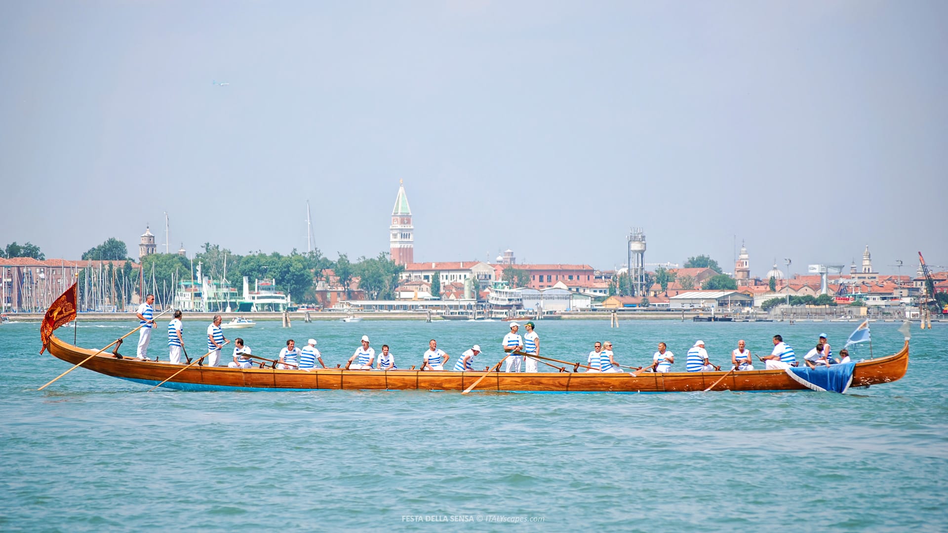
Voga alla Veneta is the traditional Venetian rowing technique, developed for the shallow waters, narrow canals, and complex channels of the Venetian Lagoon. Unlike many rowing styles, the rower usually stands upright and faces forward, allowing better visibility over the water, traffic, sandbanks, and obstacles.
This technique is closely connected to the physical geography of Venice. In a city where Venice canals function as streets, rowers needed precision, balance, and control. Standing helped them read the water ahead, while the long oar allowed them to steer, push, slow down, and correct direction in restricted spaces.
The oar is supported by the forcola, the distinctive Venetian oarlock, carved to allow different rowing positions and movements. Together, the oar and forcola make it possible to maneuver boats without a conventional rudder. This was essential in narrow canals, where quick corrections and subtle control were often necessary.
Voga alla Veneta is used with several traditional lagoon boats, including gondolas and other flat-bottomed, keel-less Venetian craft. These boats were suited to shallow water and urban navigation. Their form reflects the same practical logic as the canals themselves: everything in Venice developed around water, space, and movement.
Today, Voga alla Veneta survives as both a practical skill and a cultural tradition. It appears in local rowing clubs, training schools, lagoon events, and historic regattas. The most famous public expression is the Regata Storica, where decorated boats and competitive rowing recall Venice’s long maritime identity.
Vogalonga is a non-competitive rowing event created in 1974 to defend traditional rowing and protest against motorboat waves damaging Venice canals. The route covers about 30 kilometers through the lagoon and past islands such as Burano and Murano, celebrating Venice’s historic bond with water.
Boat Transport in Venice – Vaporetti, Water Taxis, Gondolas, and More
Transport in Venice is inseparable from water. In the historic center, ordinary cars cannot circulate through the inner urban fabric. Movement depends on walking and boats. This gives Venice a rhythm unlike that of modern road-based cities, where streets, traffic lights, parking, and vehicles dominate daily life.
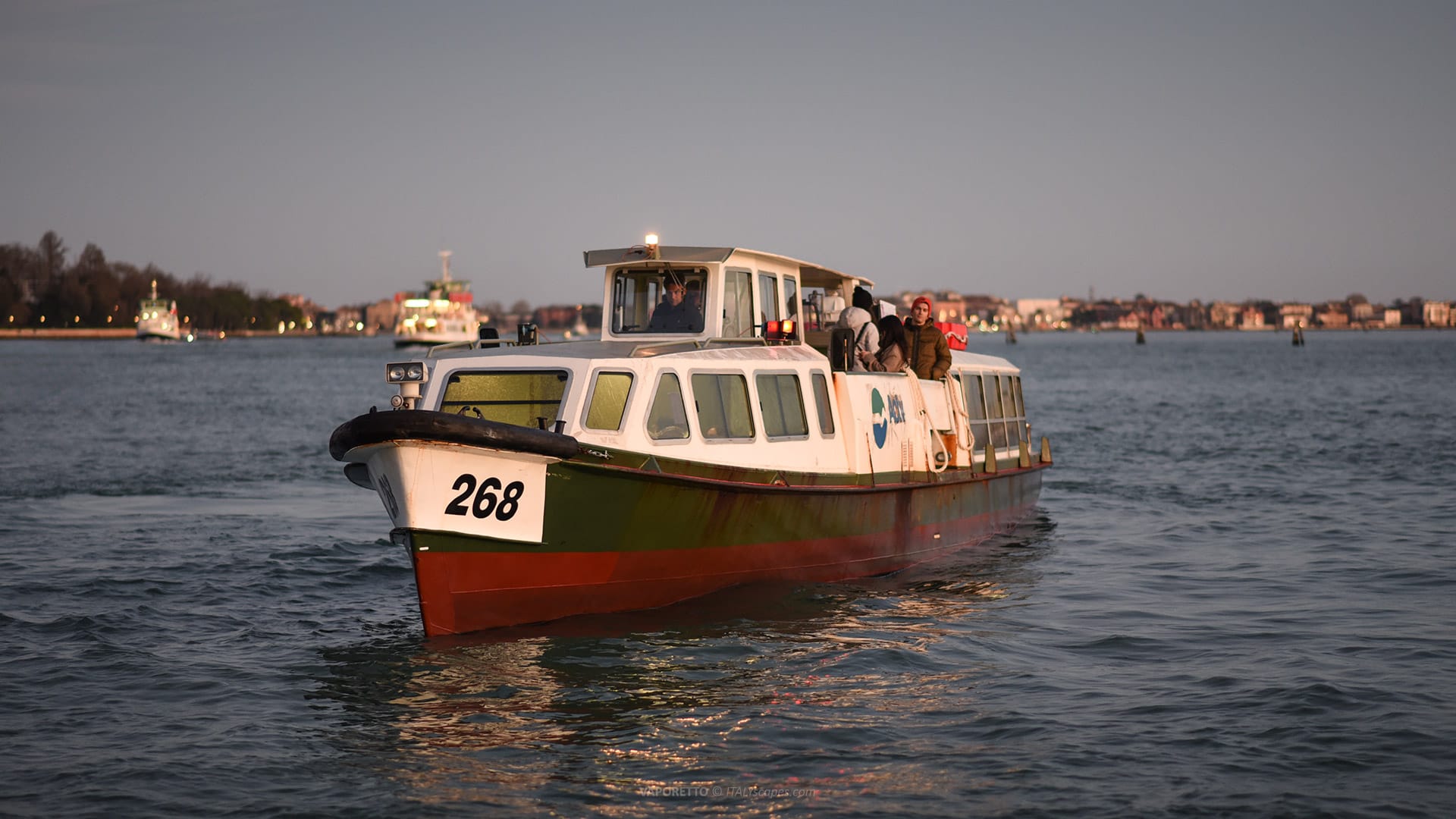
The vaporetto is the main form of public water transport. These water buses operate along major routes, including the Grand Canal, the Giudecca Canal, and connections with lagoon islands. For residents, workers, students, and visitors, vaporetti provide the closest equivalent to buses or trams in a normal city.
Vaporetti are practical, not only scenic. They connect railway access, Piazzale Roma, San Marco, Rialto, Lido, Murano, Burano, Giudecca, and other important points. Their routes show how Venice depends on water corridors for public mobility across both the historic city and the wider lagoon.
Water taxis offer a different form of transport. They are faster, more private, and more expensive than vaporetti. They can connect hotels, airport routes, private landings, and canal-side destinations where access is possible. In a city of water, they perform many functions similar to private cars or hired vehicles elsewhere.
Gondolas are the most famous Venetian boats, but their modern role is mainly ceremonial, traditional, and touristic. Historically, gondolas were practical transport for residents and elites. Today, they symbolize Venice, but they no longer form the backbone of ordinary urban movement in the way public boats do.
There are also traghetti, large gondola ferries used to cross the Grand Canal at specific points. They are short-distance services rather than sightseeing rides. Their existence is practical because the Grand Canal has relatively few bridges, and crossing by boat can save time for pedestrians.
Service boats are equally important. Venice uses boats for deliveries, construction materials, police, fire services, medical emergencies, waste collection, maintenance, and funerals. This is one of the clearest signs that Venice canals are not stage scenery. They are working infrastructure for an inhabited city.
Venice as a Unique City Built on Water
Venice is unique because its identity, geography, architecture, transport, and history cannot be separated from water. Other cities have rivers, ports, or canals, but Venice is structurally different. Its historic center is an urban system where water is not peripheral. Water is the condition of existence.
The city’s water-based form also influences how visitors experience time. Movement is slower, more indirect, and more visual. A vaporetto ride can feel like crossing a museum by water, while a walk through minor canals reveals quiet corners beyond the famous monuments. Venice demands attention to route and rhythm.
Its uniqueness is also technical. Building on lagoon islands required foundations, embankments, canal edges, drainage solutions, and constant maintenance. The city’s survival depends on inherited knowledge and modern protection. Venice is historic, but it is not frozen. It must be continuously defended from water, even as water defines it.
Venice canals should not be reduced to romantic postcard images. They are the key to the city’s geography, economy, architecture, mobility, and identity. To study the canals is to study Venice itself, because the city’s history flows through them.
Frequently Asked Questions about Venice Canals
Why are Venice canals so important?
Venice canals are essential because they function as streets, transport routes, service corridors, and historical arteries. They shaped the city’s layout, economy, architecture, and daily life.
How many canals are there in Venice?
Venice has about 150 canals, crossed by more than 400 bridges. Together, they form the water network that connects islands, neighborhoods, palaces, churches, markets, and transport routes.
What is the most famous canal in Venice?
The most famous canal is the Grand Canal, or Canal Grande. It is about 3.8 kilometers long and forms the main waterway through Venice’s historic center.
Why was Venice built on water?
Venice developed in the Venetian Lagoon, where shallow waters offered protection from invasions. Over time, the lagoon became the foundation of Venice’s defense, trade, transport, and identity.
Can you swim in Venice canals?
No, swimming in Venice canals is forbidden and unsafe. The canals are active transport routes used by public boats, water taxis, service boats, gondolas, and emergency vessels.
What is Voga alla Veneta?
Voga alla Veneta is the traditional Venetian rowing style. The rower usually stands and faces forward, a practical technique developed for navigating shallow lagoon waters and narrow canals.
What is Vogalonga?
Vogalonga is a non-competitive rowing event created in 1974. It celebrates traditional rowing and protests against motorboat waves that damage Venice canals and the fragile lagoon environment.


